ANRA Logo – Updated 2022ANRA Logo – Updated 2022ANRA Logo – Updated 2022ANRA Logo – Updated 2022
  • About Us
      • ABOUT ANRA
      • Mission & Purpose
      • Enabling Legislation & Statutes
      • History
      • ORGANIZATION
      • ANRA Jurisdiction
      • Governance
      • Meet the Board
      • Meet the Management Team
      • Board Meetings
      • DOING BUSINESS WITH ANRA
      • Solicitations
      • Vendor Information
      • Conflict of Interest
      • Economic Development
      • EMPLOYMENT
      • Job Opportunities
      • How to Apply
      • ADDITIONAL RESOURCES & LINKS
      • Texas Water Development Board
      • Texas Parks & Wildlife
      • Texas Rural Water Association
      • Texas Commission on Environmental Quality
      • Texas Veterans’ Portal
  • Services & Projects
      • WATER & SEWER SERVICE
      • Holmwood Utilities
      • Prairie Grove Utilities
      • Redland Wholesale Utilities
      • North Angelina County Regional WWTF
      • Angelina County Fresh Water Supply District #1
      • CCN Service Area Viewer
      • COMPOST
      • Soil Therapy Compost
      • Neches Compost Facility
      • Biosolid Disposal
      • Wood Waste Disposal
      • Quality Assurance
      • Public Sales
      • OSSF PROGRAM
      • OSSF Overview
      • Permits & Licensing
      • Complaints
      • Authorized Installers & Providers
      • ENVIRONMENTAL LABORATORY
      • Laboratory Information
      • Business Customers: Forms & Instructions
      • General Customers: Forms & Instructions
      • Frequently Asked Questions
      • RESERVOIRS
      • Lake Columbia
  • News & Information
      • NEWS
      • Recent News & Notices
      • Job Opportunities
      • PUBLIC INFORMATION
      • Public Information Requests
      • Financial Information
      • EDUCATION & OUTREACH
      • Programs & Projects
      • Coloring & Activity Books
      • Educational Videos
      • Lesson Plans & Modules
      • Request a Presentation
      • PUBLICATIONS & REPORTS
      • Publications & Reports
      • DATA
      • Stream Gages
      • Reservoir Levels
      • Monitoring Sites
      • Maps
      • COMMUNICATION
      • Contact Us
      • Events
  • Conservation & Recreation
      • WATER QUALITY ACTIVITIES
      • Clean Rivers Program
      • Monitoring Sites & Water Quality Data
      • Clean Water Act
      • Water Quality Education and Outreach
      • Environmental Investigations
      • WATER CONSERVATION & DROUGHT CONTINGENCY PLANNING
      • Tips to Conserve Water
      • Reservoir Levels
      • U.S. Drought Monitor Map
      • Regional Water Planning
  • Bill Pay
      • ONLINE BILL PAY
      • Pay Now
      • Set Up Autopay
      • Online Bill Pay FAQ
      • GENERAL BILL PAY INFORMATION
      • General Bill Pay FAQ
✕
            No results See all results

            10633 – Angelina River at SH 204

            • Home
            • Conservation & Recreation
            • Water Quality Activities
            • Monitoring Sites & Water Quality Data
            • 10633 – Angelina River at SH 204
              Show all

              10633 – Angelina River at SH 204

              October 28, 2022
              Categories
              Tags

              Angelina River at SH 204 - TCEQ ID: 10633
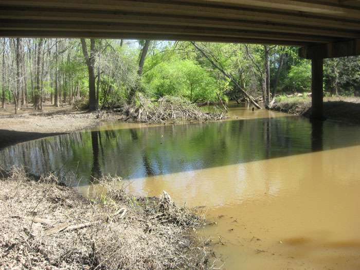
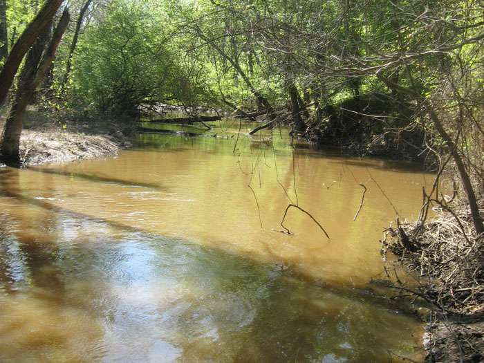
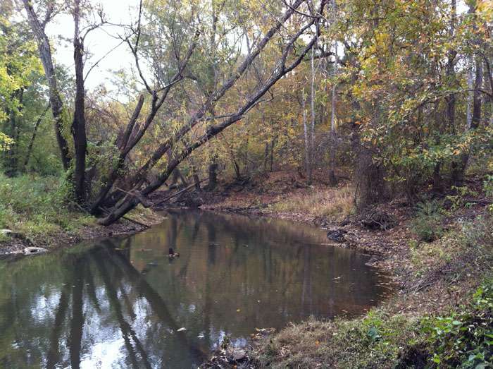
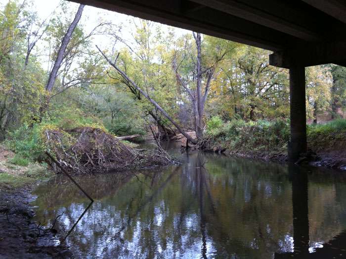
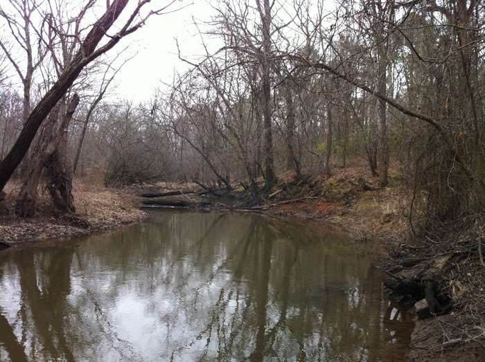
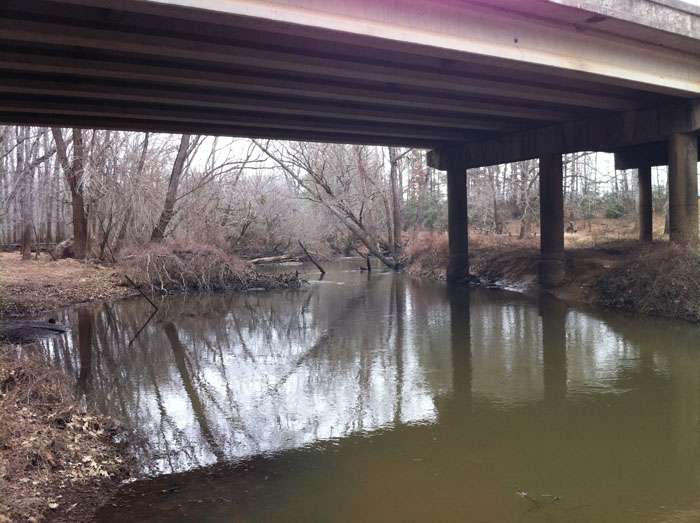
              Site Description

              Angelina River 340 meters upstream of SH 204; 9.93 km West of Cushing.

              Beginning August 2011, in order to continue sampling ambient river water rather than water discharged from the new outfall just upstream of the highway crossing, sampling at this site will be performed 340 meters upstream from the highway crossing. The location map and description have been updated to reflect this change.

              Segment Description

              Segment 0611 – Angelina River Above Sam Rayburn Reservoir. This freshwater stream encompasses a length of 104 miles and extends from the Upper Angelina sub-basin to the Lower Angelina sub-basin. Segment 0611 originates from the aqueduct crossing 0.6 miles upstream of the confluence of the Paper Mill Creek in Angelina/Nacogdoches County to the confluence of Barnhardt Creek and Mill Creek at FM 225 in Rusk County. The designated uses for this segment include contact recreation, high aquatic life use, fish consumption use, public water supply use, and general use. This segment has two areas that are currently listed on the 303(d) list due to bacteria. The listings were placed on the 303(d) list in the year 2000 and are currently categorized as 5a (2008), indicating a total maximum daily load (TMDL) is underway or scheduled.

              Monitoring Performed Quarterly

              Field Parameters
              Days Since Last Significant Rainfall
              Dissolved Oxygen
              Flow Severity
              Instantaneous Stream Flow
              pH
              Present Weather
              Secchi Transparency
              Specific Conductance
              Total Water Depth
              Water Temperature
              Conventional Parameters
              Ammonia-N
              Chloride
              Chlorophyll-a
              Pheophytin-a
              Sulfate
              Total Dissolved Solids (TDS)
              Total Nitrate+Nitrite
              Total Phosphorus
              Total Suspended Solids (TSS)
              Bacterial Parameters
              E. coli


              Photos


              click here to open in a new window

              360 Degree View


              Map


              Monitoring Stations

              0604 - Neches River below Lake Palestine
              • 10478 – Cedar Creek at FM 2497
              • 10479 – Cedar Creek at Loop 287
              • 10487 – Hurricane Creek at Loop 287
              • 10492 – Jack Creek at FM 2497
              • 10493 – Jack Creek at SH 94
              • 10494- Jack Creek at FM 3150
              • 10499 – Biloxi Creek at County Road 216
              • 10585 – Neches River at US 69
              • 13528 – Cedar Creek at FM 1336
              • 13529 – Hurricane Creek at SH 324
              • 16096 – Piney Creek at FM 358
              • 16097 – Biloxi Creek at FM 1818
              • 16098 – Buck Creek at FM 1818
              • 17339 – Lake Ratcliff
              • 21433 – Hurricane Creek below Kiwanis Park
              • 21434 – Cedar Creek at Ellis Ave
              0610 - Sam Rayburn
              • 15361 – Ayish Bayou at SH 103
              • 15523 – Sam Rayburn Reservoir Adjacent To Alligator Cove
              • 15524 – Sam Rayburn Reservoir near Shirley Creek
              • 21100 – Sam Rayburn Reservoir downstream of Marion’s Ferry
              • 21431 – Ayish Bayou at West Columbia Street
              • 21432 – Carrizo Bayou at SH 21
              0611 - Angelina River above Rayburn
              • 10474 – La Nana Bayou at CR 526
              • 10532 – Mud Creek at US 84
              • 10630 – Angelina River at SH 21
              • 10633 – Angelina River at SH 204
              • 10635 – Angelina River at FM 1798
              • 14477 – Mud Creek at US 79
              • 15801 – Lake Nacogdoches, Main Pool
              • 16301 – La Nana Bayou at N Loop 224
              • 17822 – Lake Striker, Upper Lake
              • 17824 – Lake Striker, Upper Lake
              • 20792 – La Nana Bayou at East Main
              • 21021 – Lake Nacogdoches, Upper Lake
              • 21429 – Bowles Creek at CR 4194
              • 21430 – Johnson Creek at CR 476
              0612 - Attoyac Bayou
              • 10636 – Attoyac at SH 21
              • 15253 – Attoyac at SH 7
              • 16076 – Attoyac at US 59
              • 20845 – West Creek at FM 2913
              • 21435 – Lake Naconiche, Main Pool

              The Angelina & Neches River Authority shall conserve, store, control, preserve, use, and distribute the stormwater, floodwater, and the water of the rivers and streams of the state in the Neches River Basin for the benefit of the human environment and the natural environment.

              Latest News

              • Boil Water Notice Rescinded (June 21, 2022)
                June 21, 2023
              • Boil Water Notice Issued (June 17, 2023)
                June 17, 2023
              • Prairie Grove June Update #1
                June 17, 2023
              • Stage 5 Drought Contingency Implementation Notice Reminder for Prairie Grove Utilities
                June 16, 2023
              • Prairie Grove Utilities Rate Increase Notice
                June 1, 2023

              Public Notices

              • Holmwood Utilities
              • Prarie Grove Utilities

              Popular Pages

              • Bill Pay
              • On-Site Sewage Facilities
              • Stream Gages
              • Reservoir Levels
              • Employment
              © 2022 Angelina & Neches River Authority.
              Website Design & Development MasseyMedia, Inc.